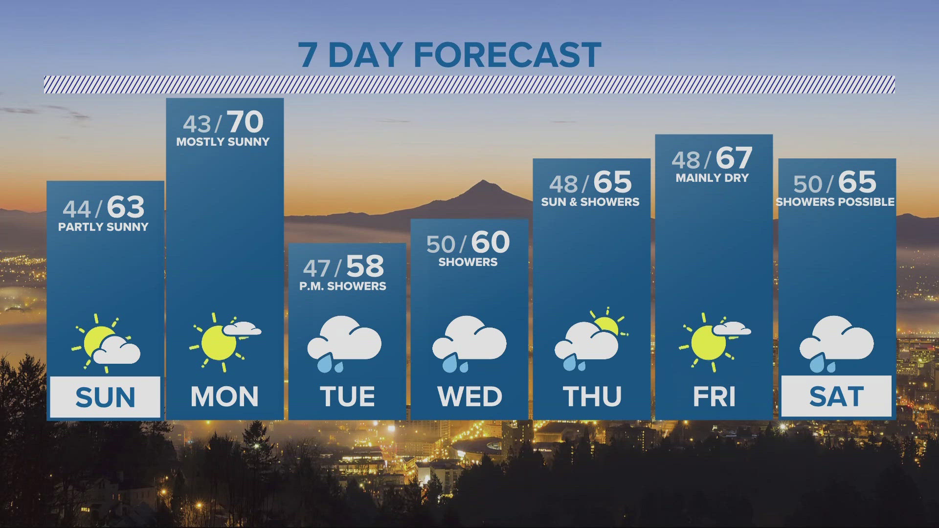
PORTLAND, Ore. — An active December with low snow levels and a threat of valley snow in the coming days is a weather story that may hang around through the New Year.
Corvallis saw snow fall Monday morning, with a temperature as low as 33 degrees. The snow level has been near 1,000 feet over the Coast Range. The snow level over the Cascades has generally been holding around 1,500 feet. Mountain passes are snow covered over The Cascades and the Coast Range Monday evening.
Showers will be tapering off overnight. Any clearing will allowing temps to drop to near freezing in Portland and Salem.
As the temperature drops Monday night there may be a few snow flurries but nothing substantial will fall in the valleys.
Wednesday starts with a rain/snow mix
The next weather system arrives Wednesday morning. If we get enough east wind pulling colder air through the Gorge into the Portland area, the chance of snow in the city goes up. Right now, the most likely scenario is a rain snow mix on the valley floor. Some brief accumulations of less than a half-inch are possible, but nothing that would be impactful to drivers.
But the air should be cold enough for sticking snow with just a little bit of elevation. Areas above 500 to 1,000 feet may see an inch or two of snow, and that would make roads like Burnside Summit and Skyline Blvd slippery.
A white Christmas?
We can always hope. The odds are never great in Portland, but the cold pattern that developed this weekend looks like it may stay in place through the month. The snow level will bounce around a bit, but generally stay down around 1,000 feet.
There are some way-too-early indications in the long range guidance that even colder air from the north may drop in around Christmas. It's the type of pattern that can bring valley snow, but it's way too soon to nail down the details. And often times, the long range guidance completely changes its tune when looking that far out in the future.
For now, plan on lots of snow in the mountains, and colder than normal weather in the valleys.