
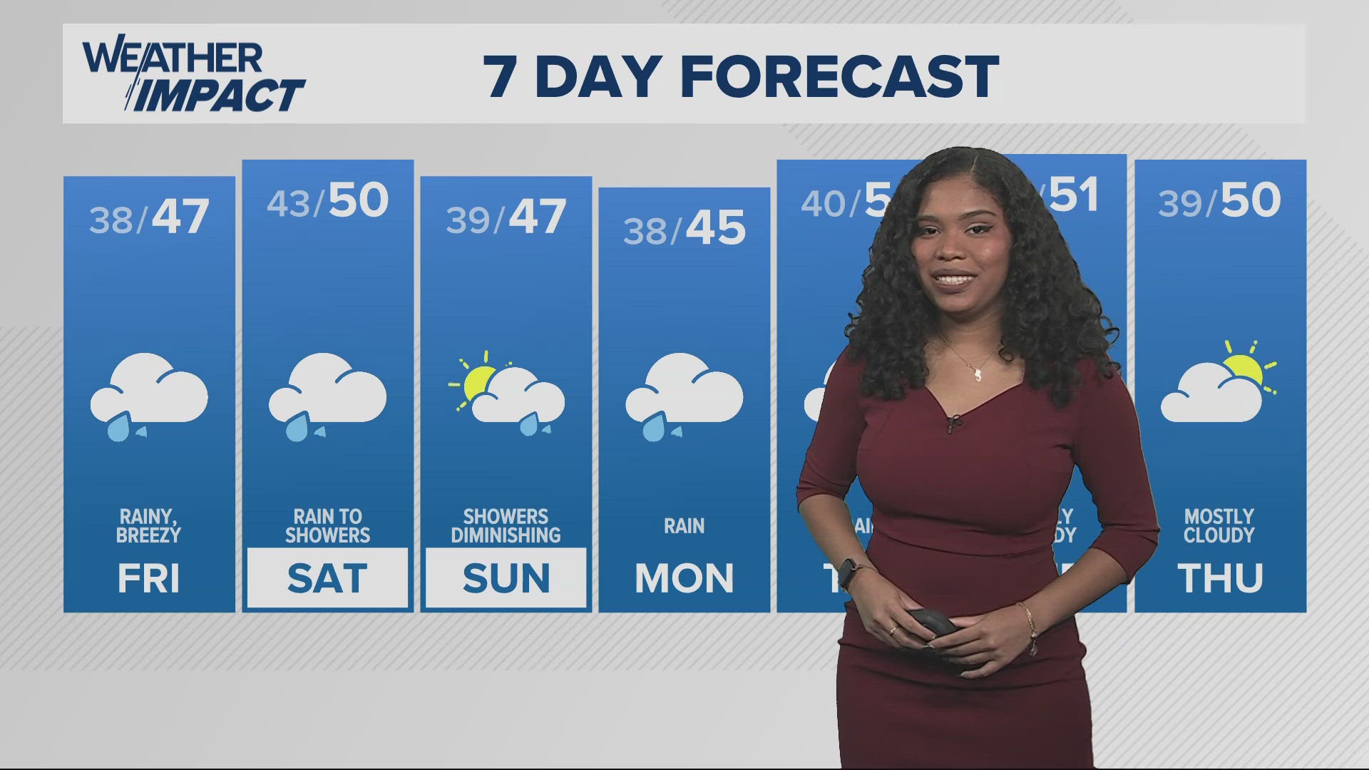
PORTLAND, Oregon — Rainfall was relatively light all day long in the metro area, with us collecting around a quarter of an inch of rain throughout the day. While there’s no more considerable rainfall throughout the evening hours, we are expecting much more rain Friday. By late Friday morning, we should be seeing the precipitation return, which will last through the day. By Saturday morning we are likely to see around three quarters of an inch of rain in the metro area, and around an inch and a half along the coast.
Also expect it to be a bit breezy in the Willamette Valley, with the real winds moving through the coast and in the Columbia River Gorge, around 30 miles per hour in both areas.
By Saturday the rain turns into light showers, and by Sunday, we shouldn’t see any significant precipitation, before more rain moves in with the next system on Monday.
In the meantime, also look out for snow along the passes by tomorrow night, around 3 to 6 inches worth. The good news is that so far, it's nothing that warrants a warning or watch at the moment for that area.
Celine Stevens
KGW Weathercaster
What are Weather Impact Alert days?
It’s our goal to make sure you have the most accurate and up-to-date information about the weather and its impact on you. The new KGW Weather Impact Alerts will be just that, alerts as far in advance as possible, so that you can be armed with accurate information to keep yourself and your family safe.
Extended weather reports and more on KGW+: You asked for more access to local news, weather and more at home, and we listened! Now, watching KGW News is easier than ever with the KGW+ app for Roku, Amazon Fire TV and Apple TV. Easily find live newscasts and local programs, access top videos and stream breaking news on your schedule. KGW+ offers 24-7 streaming that includes live local news, newscast replays, extended coverage, expanded weather reports, station specials and investigations. Click or tap here to learn more.