
PENDLETON, Ore. — The Hat Rock fire in eastern Oregon's Umatilla County, one of two wildfires burning in the area, is 100% contained as of Saturday morning, according to the Oregon State Fire Marshal, prompting all remaining evacuation alert areas to be reduced to the lowest alert level.
Firefighters in Umatilla County responded to two separate wildfires on Tuesday, dubbed the Mount Hebron fire and the Hat Rock fire, each threatening homes amid high winds and dry conditions.
“Our crews have worked hard to build and maintain a perimeter around the fire area," OSFM Incident Commander Lance Lighty said.
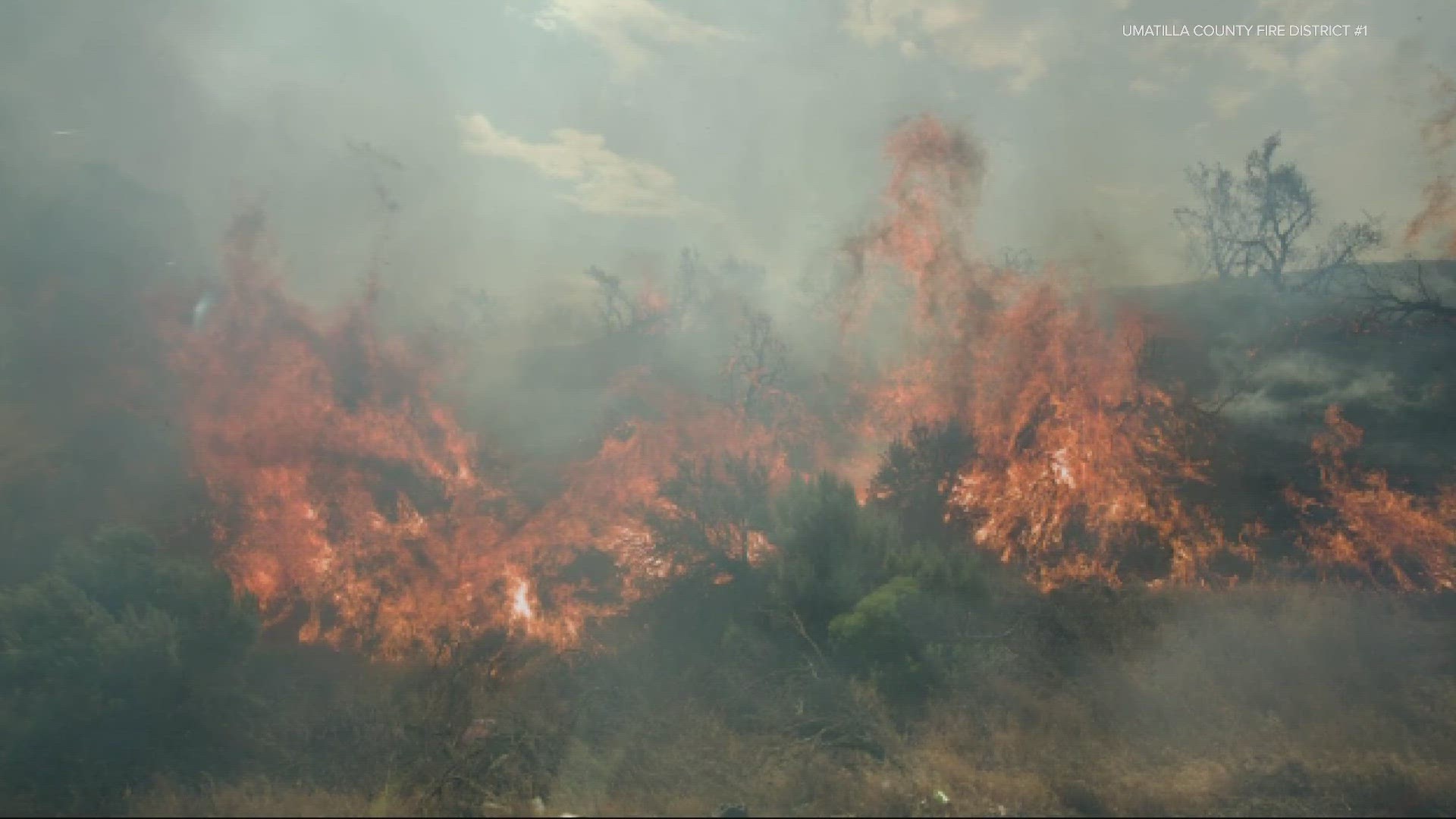
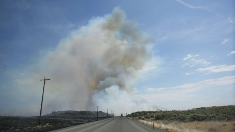
The Hat Rock fire burned more 16,816 acres, according to a Saturday release. It ignited near the intersection of Highway 37 and Highway 730 around 11 a.m. Just hours later, the Mount Hebron fire started just after 2 p.m. near Highway 11 northeast of Pendleton. It burned 370 acres.
As of Saturday morning, all evacuation orders had been lifted. Umatilla County Sheriff's Office maintained Level 1 evacuation orders along Juniper Canyon Road, Hartle Road, Wallula Road and Hatchgrade Road.
“I want to thank the Umatilla County Fire District and all the firefighters for their hard work, the landowners and community members that rose to the occasion to protect their neighbors, the Umatilla County Sheriff’s Office for their collaborative work, and the community for their support of the firefighters working long hours," OSFM Agency Administrator Travis Medema said.
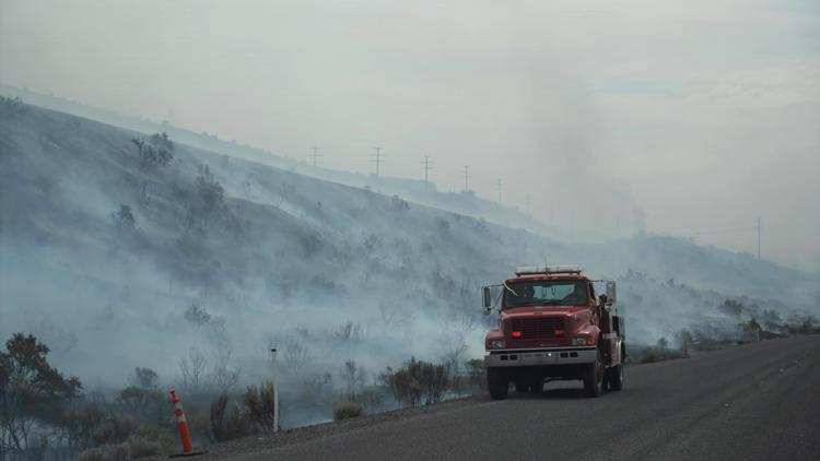
On Tuesday evening, firefighters had made substantial progress on the Hat Rock fire but the latter continued to grow. At the time, Umatilla County Fire District #1 last estimated the Hat Rock fire's size at 15,000 acres, burning across the Washington state line northeast of Hermiston.
Hat Rock State Park and a nearby RV park were temporarily evacuated, but the fire quickly moved north and east toward the border with Washington. It had crossed the state line by nightfall, burning through Juniper Canyon.
On Wednesday afternoon, the fire remained active but with much of that activity concentrated in Washington, where it was being managed under the Benton Complex.
There have been no reported injuries from either fire.
“We couldn’t have done it without the farmers’ disking line and the large community of volunteers who immediately responded,” said UCFD1 Chief Scott Stanton.
At 2 p.m. on Wednesday the Umatilla County Sheriff's Office maintained Level 3 evacuation orders along Juniper Canyon Road, Hartle Road, Wallula Road and Hatchgrade Road. Deputies and search and rescue personnel were going door-to-door on Tuesday, advising residents to leave the area.
Cpt. Sterrin Ward later clarified that the evacuations are not "mandatory," but did reflect that residents were being instructed to leave the area for their own safety. Level 3 represents the highest level of evacuation warning under Oregon's three-tiered system.

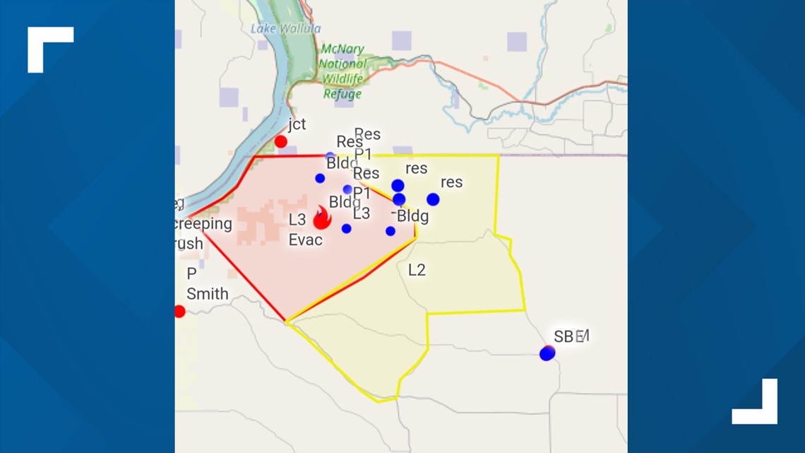
The agency also kept in place Level 2 evacuation warnings for outlying areas south and east of the fire, north of Highway 37 and Pendleton Cold Springs Highway, west of Kings Corner Road, north of South Juniper Canyon Road and west of Vansycle Road to the Washington state border.
An emergency shelter was opened at 1705 East Airport Road in Hermiston. Ward said that Red Cross members remain at the location for anyone in need of assistance.

While the Hat Rock fire continued to become a more significant threat, the Mount Hebron fire was 99% contained as of Tuesday night, estimated at about 600 acres.
Also a fast-moving fire, Pendleton firefighters and other local resources were able to quickly stop progress — getting it under control before nightfall.
While some people near the fire opted to leave their homes, they were quickly allowed back into the area. No homes were damaged, but roughly two vehicles and several outbuildings had been burned, including a hay shed.
The Oregon State Fire Marshal's office announced late Tuesday afternoon that it was mobilizing six firefighter task forces to head to Umatilla County after Gov. Tina Kotek invoked the Emergency Conflagration Act for both the Hat Rock and Mount Hebron fires.
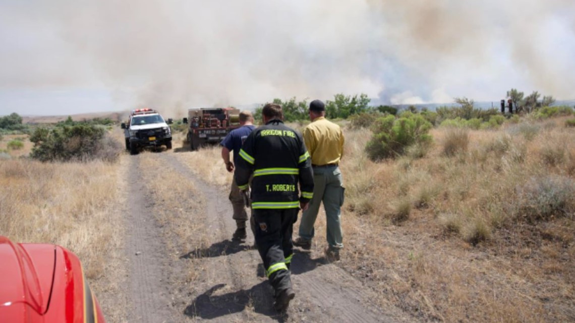
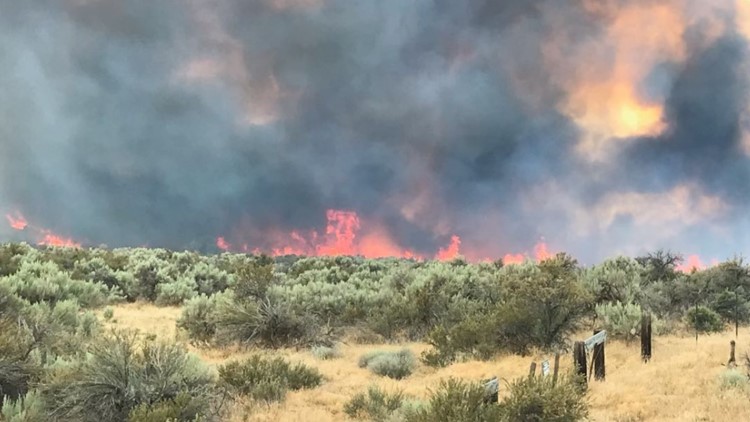
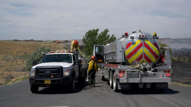
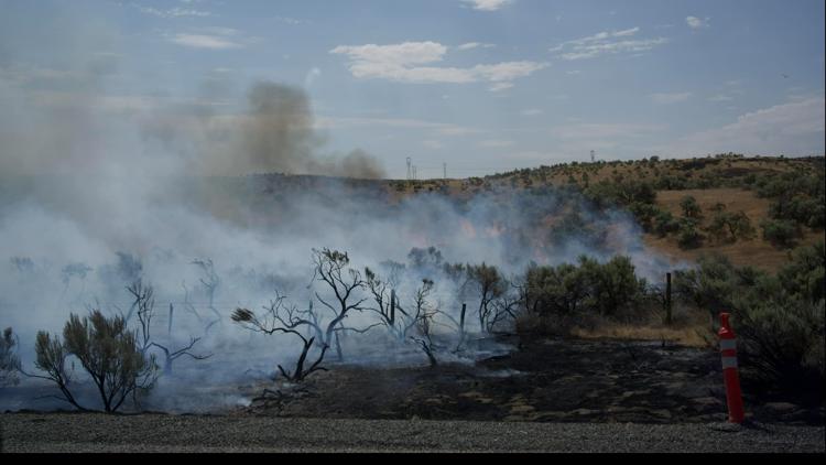
PHOTOS: Hat Rock Fire in eastern Oregon


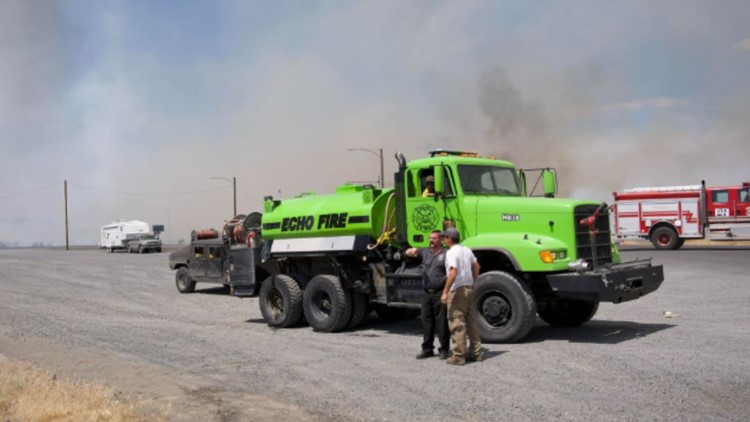


Three of those task forces had arrived by Tuesday night and began relieving local crews on the ground. Three more arrived Wednesday morning, and OSFM took over command of firefighting efforts in the area.
"The Hat Rock and Mount Hebron fires have been growing rapidly due to the dry, windy conditions in Umatilla County. The local firefighting resources from three counties have been battling both fires since they began mid-day June 13," said Oregon State Fire Marshal Mariana Ruiz-Temple in a Tuesday release. "With the red flag warning in place, the OSFM is mobilizing additional resources through the Oregon Fire Mutual Aid System (OFMAS) to help the local fire service agencies on scene."
The governor can declare a conflagration after determining that a fire "poses a threat to life, safety, and property" beyond what local resources can contain. It frees up statewide firefighting capabilities to respond.