
PORTLAND, Ore. — A Flood Watch is in effect for most of western Oregon and Washington due to an atmospheric river that is expected to bring heavy rainfall to much of the region.
The Flood Watch will remain in effect through late Wednesday night.
The National Weather Service said flooding is possible Tuesday through Wednesday due to another round of heavy rain Monday night and Tuesday.
"PDX has picked up nearly 2.5 inches of rain since Thursday night, and it's possible we pick up another 2 to 2.5 inches by Wednesday night," said KGW Meteorologist Chris McGinness. "With recent snow, and now very high snow levels over 8,000 feet, melting snow and additional heavy rain are a concern for smaller rivers and tributaries."
Where could we see flooding?
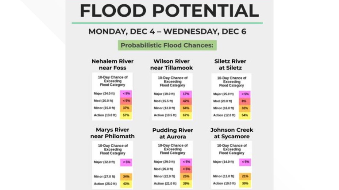
All locations at risk of flooding are west of the Cascades. The National Weather Service posted a chart showing the flood chances at several area rivers. The National Weather Service tracks 203 gauges around the area.

What are the possible impacts?
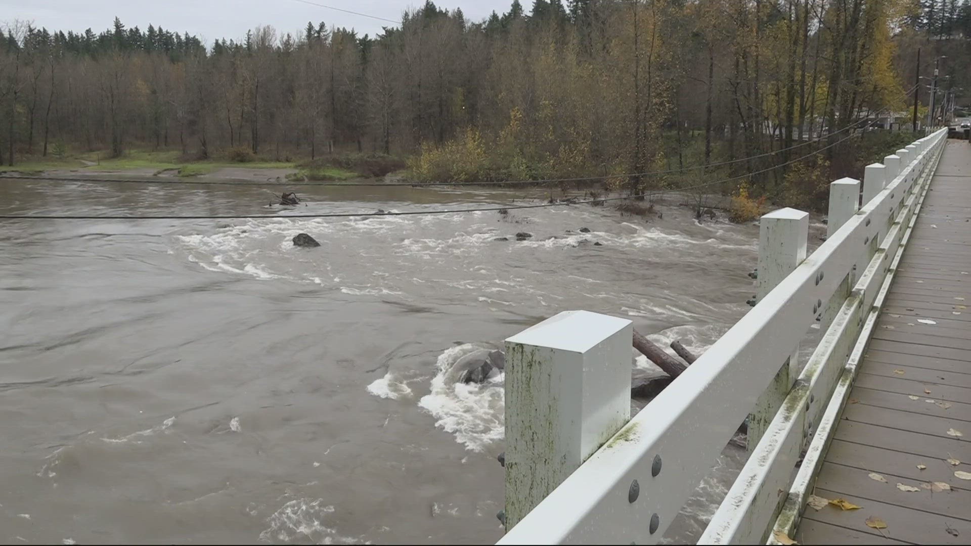
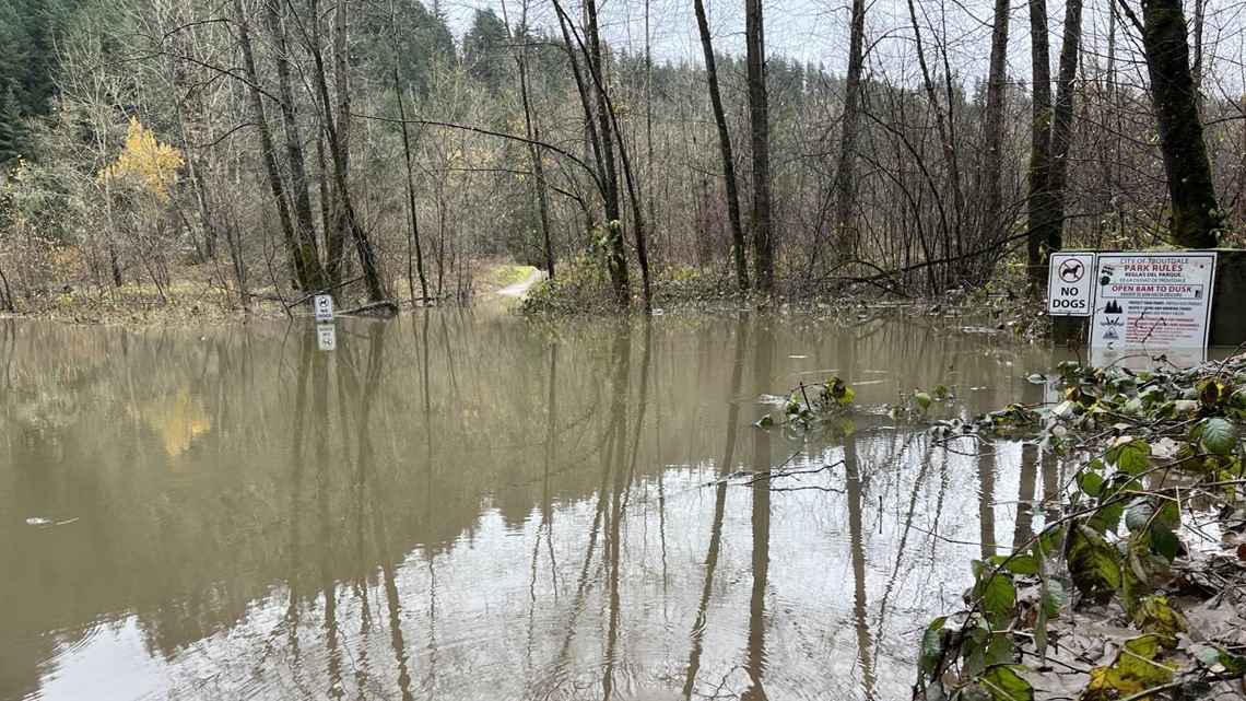
Flooding is possible along some rivers and creeks as well as flood-prone roads and trails, the National Weather Service said. Snowmelt will also add runoff for rivers in the Cascades.
On Monday, a spokesperson for Portland Fire and Rescue urged people to stay away from local rivers over the next few days.

The Portland Bureau of Transportation said workers cleared storm drains around the city during the weekend. With rain also bringing risks of landslides, crews on Monday were checking locations in the West Hills for potential landslides to see if "there's anything that could warrant some preventive maintenance."
What's an atmospheric river?
Atmospheric river is a newer name for a weather pattern in the Pacific Northwest also known as the Pineapple Express. They are long, narrow regions in the atmosphere that transport moist air from the tropics to higher latitudes, according to the National Oceanic and Atmospheric Administration (NOAA).
The plumes of precipitable moisture are often formed in areas just north of Hawaii and channel directly into the Pacific Northwest. They often release water vapor in the form of heavy rainfall and high snow levels. Atmospheric rivers can result in flash flooding and mudslides.
The difference between a flood warning and a watch?
The National Weather Service issues an advisory, warning or watch based on the severity of the event. The Flood Watch in effect now goes through Wednesday afternoon.
- Flood Warning: Take Action! A Flood Warning is issued when the hazardous weather event is imminent or already happening. A Flood Warning is issued when flooding is imminent or occurring.
- Flood Advisory: Be Aware. An Flood Advisory is issued when a specific weather event that is forecast to occur may become a nuisance. A Flood Advisory is issued when flooding is not expected to be bad enough to issue a warning. However, it may cause significant inconvenience, and if caution is not exercised, it could lead to situations that may threaten life and/or property.
- Flood Watch: Be Prepared. A Flood Watch is issued when conditions are favorable for a specific hazardous weather event to occur. A Flood Watch is issued when conditions are favorable for flooding. It does not mean flooding will occur, but it is possible.