
PORTLAND, Ore — Oregon saw a wet January with multiple days of high temperatures below freezing. What's in the forecast for the rest of February and March?
Portland and Salem are projected to see near normal temperatures and below normal rainfall for the first 15 days of February, according to outlooks from the National Oceanic and Atmospheric Administration (NOAA).
"The outlook, coupled with current forecast projections, leads to the conclusion that Portland has seen the last of bitterly cold winter weather this season," said KGW meteorologist Rod Hill.
Temperatures
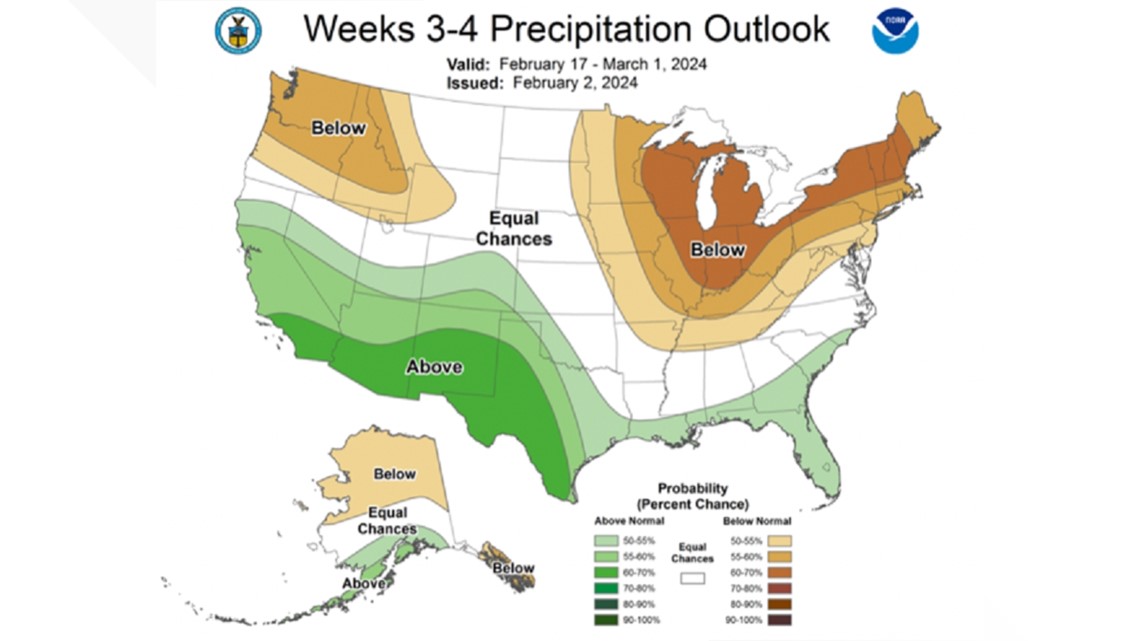
Hill said NOAA's outlooks for the back half of February — Feb. 17 through March 1 — puts the Pacific Northwest in the "highest confidence zone" to see above normal temperatures and drier than normal rainfall.
The normal climate high for this time period is the low 50s for the mid-to-north Willamette Valley. Based on NOAA's temperature outlook, Oregon could see a number of days with temperatures rising into the 60s. The outlook below shows all of the Pacific Northwest in the bullseye of experiencing above normal temperatures.

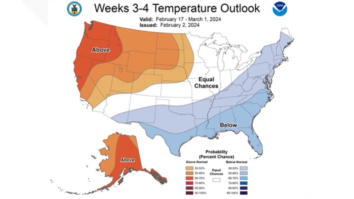
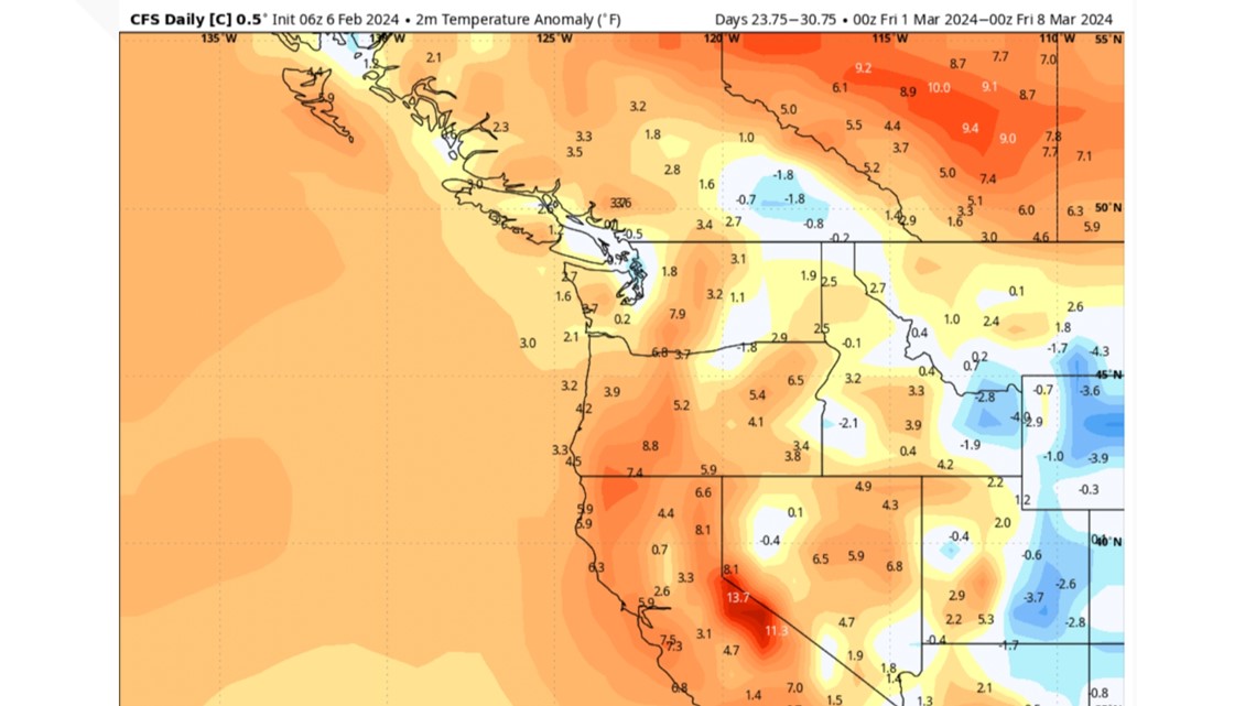
Hill pointed out a weather anomaly for the first week of March, which shows above normal mean temperatures for much of Oregon and Washington.
"The numbers would suggest a number of days with either low temperatures in the mid-40s to 50 degrees and/or highs warming into the 60s," Hill said. "The American Climate Forecast System weather model shows positive temperature departures of +3 to +7 in our local region."

Precipitation
Below normal precipitation during the end of February will seem dry when compared to the 18.6 inches of total precipitation that fell in Portland from Dec. 1 through January.
"Total precipitation the last two months is 7.36 inches above normal or nearly 170% of normal, making an extra six weeks of rainfall," Hill said.

End of March may bring cooler, wet weather
Warm weather lovers may not want to get overly excited, Hill warns, because there are signs that the back half of March will turn cooler and wet.
The timing of the colder-than-normal air would be chilly and likely not the bitter cold brought by the January Arctic air mass, when Portland saw three days of highs in the 20s, Hill said. For perspective, record cold high temperatures in mid-March are generally in the 40s.
As the start of spring approaches, Hill said a timeline of warming climate numbers shows Portland's normal high temperatures currently at 50 degrees, warming to 54 on March 1 and 57 on the first day of spring (March 19). By April 1, that number rises to 59 degrees.
Hill said Portland's final spring freeze on average is around April 1, though parts of the Willamette Valley can see freezing numbers into early May.
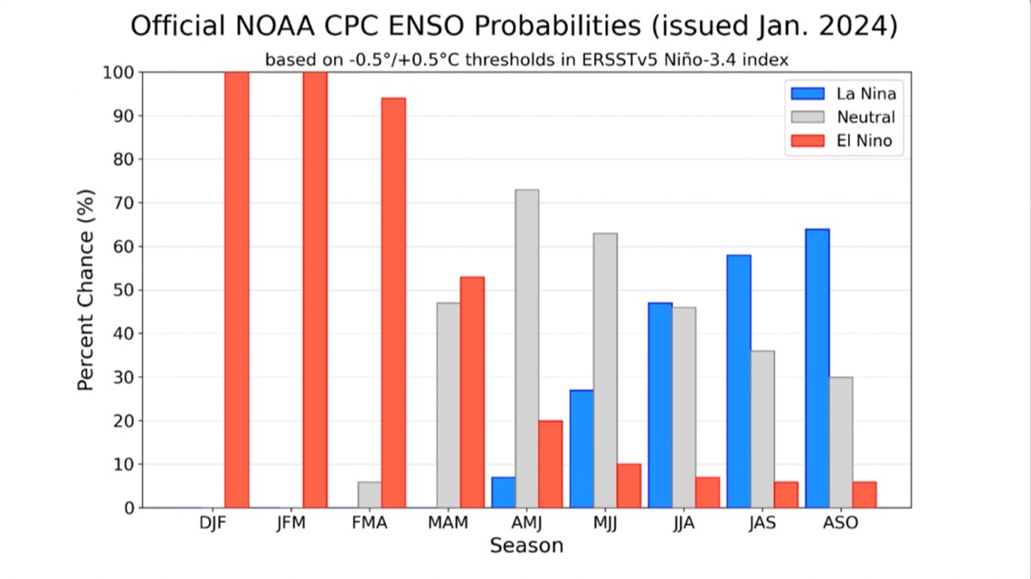
The current El Niño cycle — connected to Oregon's mild December and California's recent heavy rains — is expected to weaken into ENSO-Neutral conditions during the month of April, according to Hill. That means neither El Niño or La Niña conditions. The graph below from NOAA shows the probabilities.
NOAA projects La Niña conditions will return this summer into the fall season.

VIDEO PLAYLIST: KGW Weather