
PORT ANGELES, Wash — Three different earthquakes have registered around the north coast of the Olympic Peninsula within the past four days, according to data from the Pacific Northwest Seismic Network.
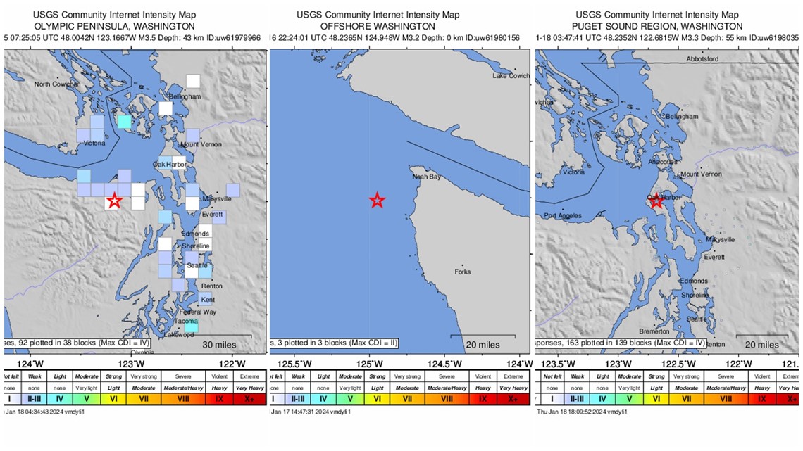
The first quake hit near Port Angeles on Jan. 14 at around 11:25 p.m. and registered at a magnitude 3.5 on the Richter scale. The quake hit 15 miles southeast of the city. According to a community intensity map compiled by PNSN based on citizen reports, light shaking was felt as far away as Victoria, British Columbia, Oak Harbor and Silverdale.
The second quake struck off the coast of Neah Bay on Jan. 16 at around 2:24 p.m., registering at a magnitude 3.2. There were three reports from British Columbia notifying PNSN that they felt weak tremors from the incident.
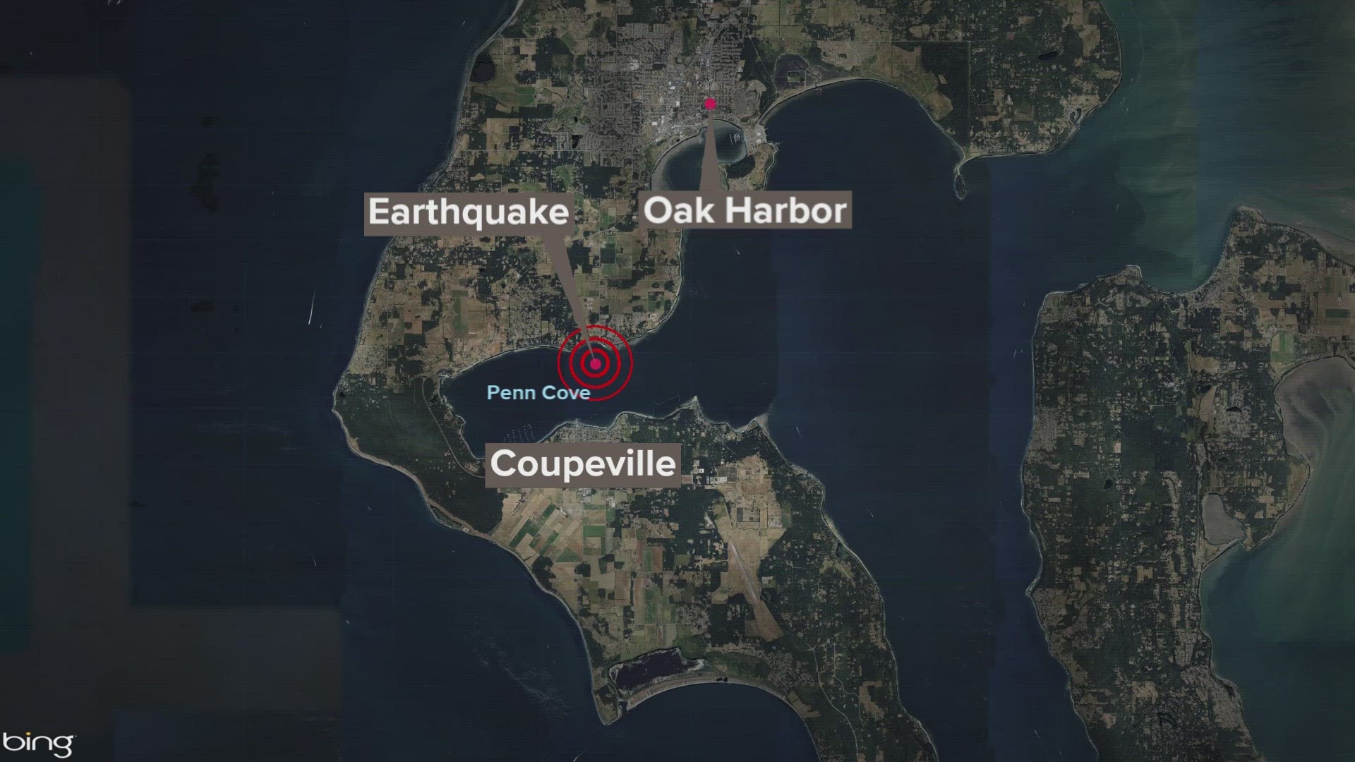
The third earthquake struck just off the coast of Whidbey Island originating from Penn Cove at around 7:47 p.m. on Wednesday night. The quake registered as a magnitude 3.3. Dozens of people reported feeling weak tremors from the quake in Coupeville, Oak Harbor, Port Ludlow, Port Townsend and Camano Island. It was felt as far away as Sidney and Victoria, B.C.

Harold Tobin, director of the Pacific Northwest Seismic Network, said while this number of earthquakes in this area over a period of four days is more than average, it's "not particularly remarkable." At times there are more or fewer earthquakes reported in that area within the same span of time and the number is within the "normal" range for a region this seismically active.
A magnitude 3 earthquake is thought to be minor, with those near the epicenter being able to feel it but not generally causing damage.
Anyone who felt the most recent earthquake is encouraged to fill out a Felt Report on the PNSN website, which helps the organization compile information on the intensity, reach and impact of an earthquake.
Earthquakes around western Washington
Many earthquakes in Washington state are linked to the motion of the Juan de Fuca Plate and the North American Continental Plate moving against each other as the Juan de Fuca Plate slips beneath the North American continent, according to PNSN. This is called the Cascadia Subduction Zone.
According to the Washington State Department of Natural Resources (DNR), earthquakes happen in Washington every day, but most are too small to be felt. The state has the second highest risk in the U.S. of experiencing a large and damaging earthquake because of its geologic setting.
The Pacific Northwest typically experiences three types of earthquakes:
- Shallow fault quakes: Ruptures in faults located in the upper 18 miles of the Earth's crust. These earthquakes typically last 20 to 60 seconds and shaking is localized to the area near the fault, according to the DNR.
- Deep earthquakes: Deep faults happen when two tectonic plates collide and one plate slips beneath the other one. These quakes can impact a large area but are less intense.
- Subduction zone earthquakes: This earthquake results from the tension of an oceanic plate slipping beneath a continental plate. When enough stress builds, the fault will rupture, releasing a massive amount of energy. The Cascadia Subduction Zone has the potential for these types of earthquakes and has ruptured in the past. It is one of Washington state's biggest hazards, according to DNR.