Hurricane Matthew is a monster. It also seems to have a mind of its own. It strengthened way beyond any of the official forecasts from the National Hurricane Center and the world's cumulative centuries of meteorological experience. Forecasts were for a Cat 2, maybe a Cat 3 ... slowly developing thru early next week. Instead it jumped 4 categories to the strongest Cat 5, overnight! When everyone -- and I mean everyone -- gets the intensity so categorically wrong, it raises an eyebrow and reminds us that while we think we're in control, we're not. Tropical weather forecasting may be too infinitely complicated for us to ever truly grasp an ability to accurately project a system's strength (and path.) That's why when there's anything 'tropical' in the Gulf, we seem to obsess about it because so much can change so fast -- and it can mean life or death.
#Matthew: most powerful hurricane in our ocean basin in nearly a decade. Moving toward Jamaica. No #Houston threat. pic.twitter.com/ceDTInWtpq
— Brooks Garner⚡️ (@BrooksKHOU) October 1, 2016
Here are some distinguishing stats on Matthew
- It's the farthest-south forming Cat 5 in recorded human history. Its orientation to the equator would typically slow the spinning motion needed to strengthen a hurricane. The Coriolis effect from Earth's rotation is almost non-existent as you get close to the equator. Without that help, it's harder for a system to develop.
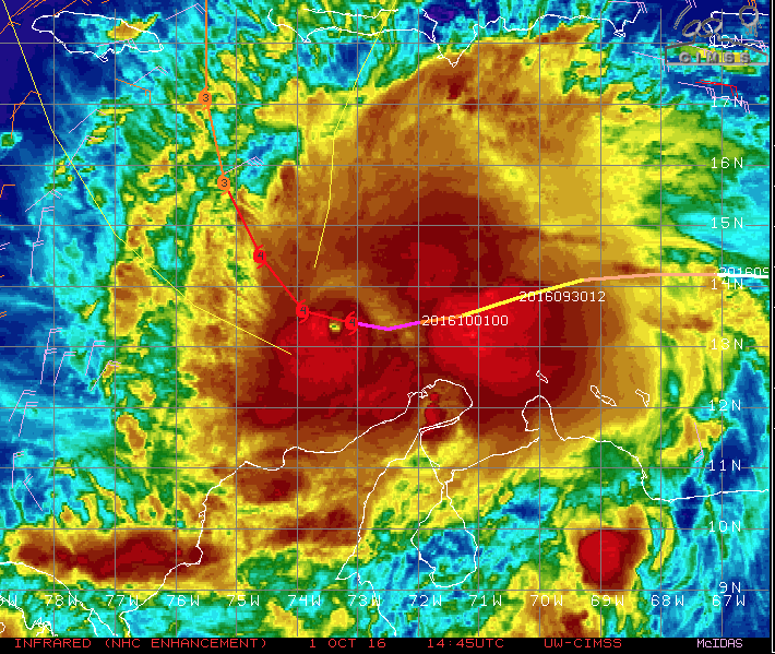
- Matthew strengthened overnight from a Cat 1 to a Cat 5 in an explosive example of rapid intensification.
- Matthew is the strongest hurricane in the Atlantic basin in nearly a decade. Felix in 2007 was the last Cat 5.
As it heads toward Jamaica, Haiti and Cuba (no threat to Houston, or to Texas), it's going to bring huge destructive capability -- especially if it hits Haiti, which is a developing country, reeling in unimaginable poverty. Flash flooding and mudslides on that deforested island nation could kill many people and cause much suffering. Wind damage in Jamaica could cause huge interruptions in their tourism industry and lives could be lost. The same applies to Cuba (Guantanamo Bay could be slammed) and also the Bahamas.
#Matthew: Briefly became a Cat 5 overnight. Farthest south-forming Cat 5 in recorded history! No #Houston threat. pic.twitter.com/cll3iQSKhl
— Brooks Garner⚡️ (@BrooksKHOU) October 1, 2016
Its track northward toward the east coast of the US could mean huge problems for areas like Florida, the coastal Carolinas, and even coastal New England. As its rapid intensification has proved, the tropics are hard to predict so if you need to know its track, watch the weather at least once a day until the threat passes next weekend.