
CORVALLIS, Ore. — Researchers as Oregon State University have developed a new 3D model that allows them to take a closer look at what’s happening beneath the earth’s surface along the Cascadia Subduction Zone.
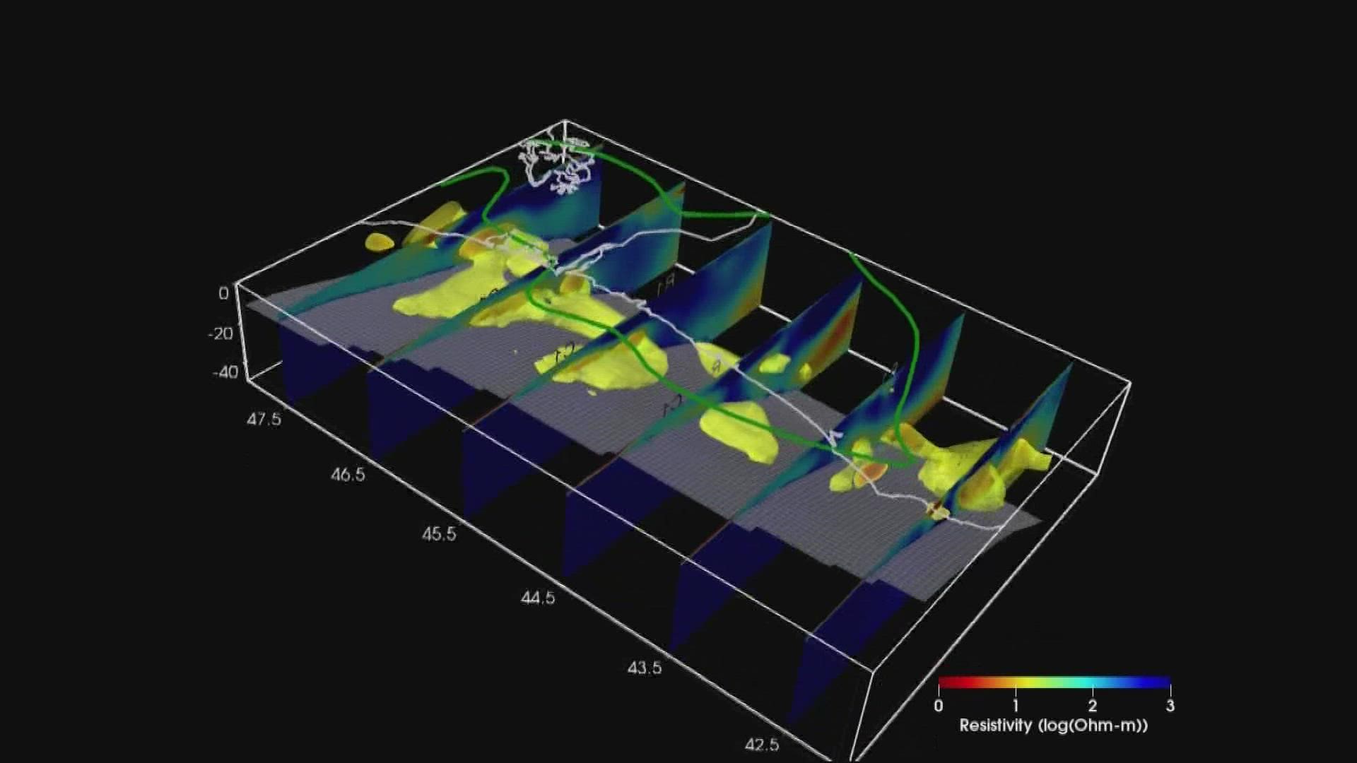
The model is providing new insight into the strength and composition of the rocks that lie along the floor of the Pacific Ocean near the Oregon coast, focusing on an area about 25 miles beneath the ground.
There's fluid developing in the Earth's crust at that depth, and the researchers have been studying it to try to find out what that could mean in the event of a large earthquake — the kind predicted to occur sooner or later in the Pacific Northwest.
One of the model's developers is Gary Egbert, a researcher and professor at OSU's College of Earth, Ocean and Atmospheric Sciences for over three decades. He’s been focusing on a particular area of the Cascadia Subduction Zone known as Siletzia, which stretches from Vancouver Island to Roseburg.
The research shows that area doesn't allow for as much water to get into parts of the crust, he said, so he's been paying close attention to the type of rock that sits along that portion of the zone.
“Where does this rock stop, and where does the sediment begin?" he said. "And so I think one of the real key things is that we can tell that these sedimentary rocks are pushed underneath the continental edge."
RELATED: Oregon State researchers study how fallen trees, logs in waterways benefit land-based animals
Egbert said the 3D modeling has allowed him to see where the weaker rocks are located, and where the stronger rocks tend to be found. That information could help determine how some rocks deep below the Earth's surface can withstand more pressure than others.
The modeling can also help determine how far the rupture will extend when the big earthquake arrives, he said — but more research needs to be done to se what that will mean in terms of the amount of damage the earthquake could potentially cause.