
PORTLAND, Ore. — We’re halfway through winter! After such a wet and mild January (7.58” of rain and 4.4° above average for the month), who was expecting snow Monday morning?
Several schools across the area had late openings (Corbett was closed), and even downtown managed to see some wet snowflakes.
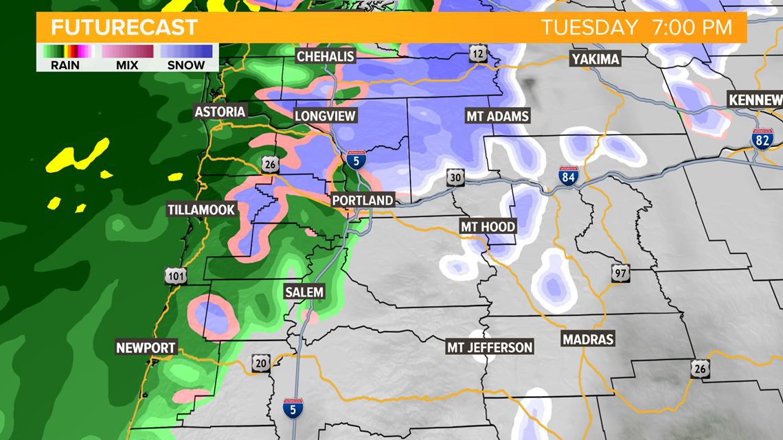
Monday should wind up being a cool, but partly to mostly sunny day in Portland. The next round of rain moves in later Tuesday afternoon.

A quick check on our longer range outlook: Looks like we could see a shot of some cooler weather late this weekend and into next week, which could set up for weekend snow in the passes.
As we get deeper into the month, our chances for measurable valley snow decrease, but it’s still not out of the question yet.
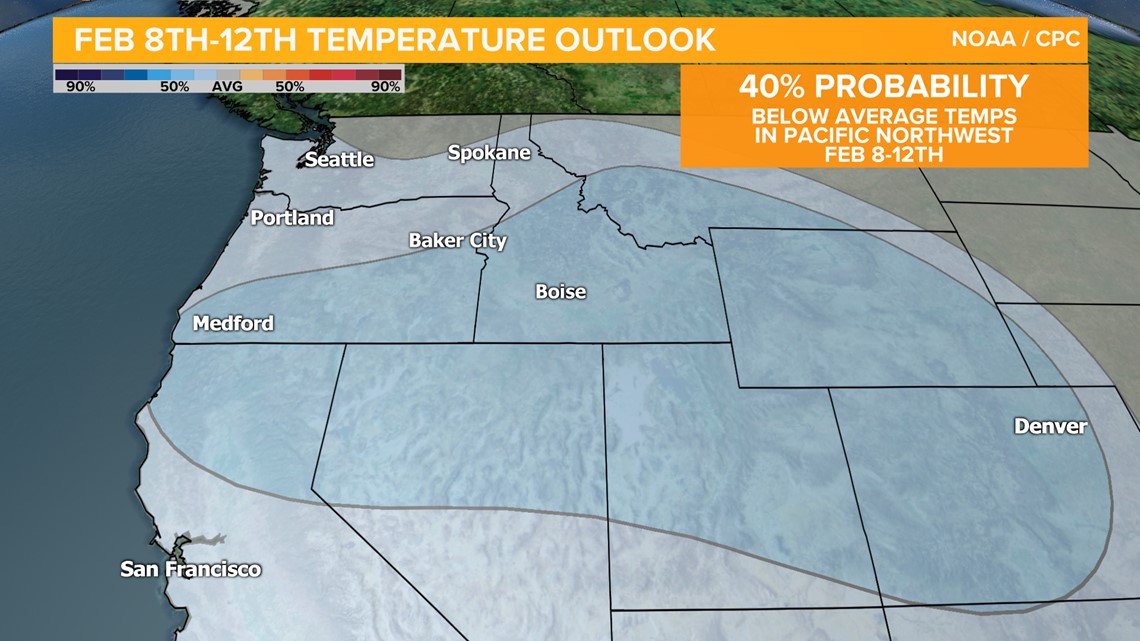
The snapshot of the futurecast above shows our next round of rain due in later Tuesday, and below is the Climate Prediction Center temperature outlook for next week. Note that we’re looking at 40% chance of below-average temperatures. The average high/low for next week is about 51°/36°

If you’ve got a topic you’d like us to tackle in KGW Weather Extra, reach out to me on Twitter or Facebook, or you can email cmcginness@kgw.com