PORTLAND, Ore. — Just in case one round of April snow wasn't weird enough, Portland might be lined up for a second dusting before the week is over.
It's not a sure thing, but according to KGW meteorologist Rod Hill, weather conditions could allow for more low-level snow overnight and into Wednesday morning, when a new weather front moving inland from the northwest will bring increasing moisture.
Temperatures might be warmer than on Monday morning at low elevations, he said, but ground temperatures could still be down in the range of 32 to 35 degrees, which could lead to wet sticking snow.
That could mean a dusting of up to 2 inches of snow at low elevations and 4 inches or more in the high hills with closer to 1,000-feet elevation.
"So the range of possibility for Salem, downtown Portland and Vancouver goes from no sticking snow to snow in the air with temps at 36 or warmer, to near-freezing and the snow amounts mentioned," he said.
Sandy could see as much as 6 inches over 24 hours, and heavy snow will continue over the Cascades and Coast Range.
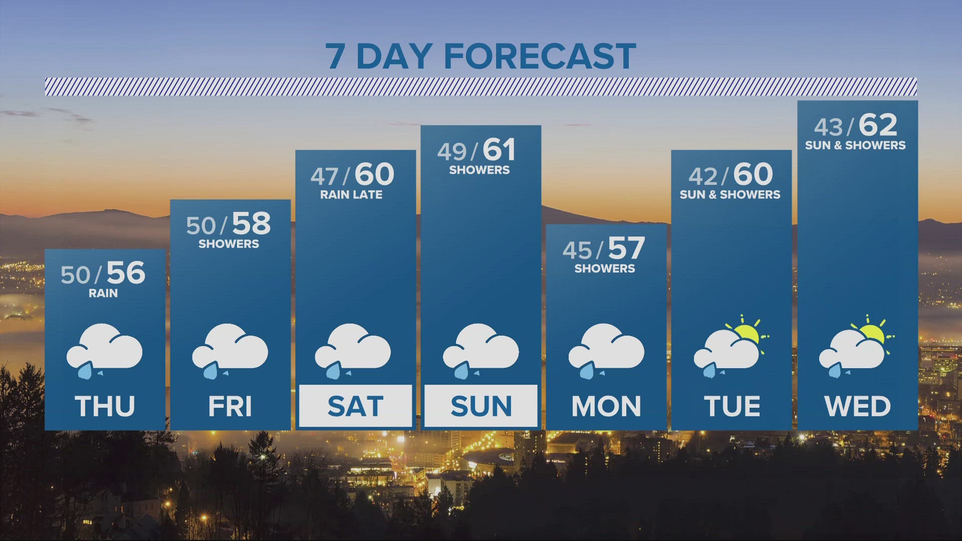
High-moisture conditions will continue after Wednesday, but a third round of snow isn't in the cards; Thursday's moisture will be all rain in Portland, according to Hill's forecast, and temperatures should start to warm up on Friday.
Rain showers will continue on Saturday, but Sunday should be dry and mostly sunny with temperatures nearing 60 degrees. Rain will resume on Monday when the next weather front arrives.