
PORTLAND, Ore. — While forecasters continue to look out for the possibility of snow in Portland next week, snow is a certainty in the Cascades over the next week. The real question is how much?
There’s still a lot that can change but KGW chief meteorologist Matt Zaffino says it can be anywhere from three feet to six feet in the Cascades through next Tuesday, Jan. 14.
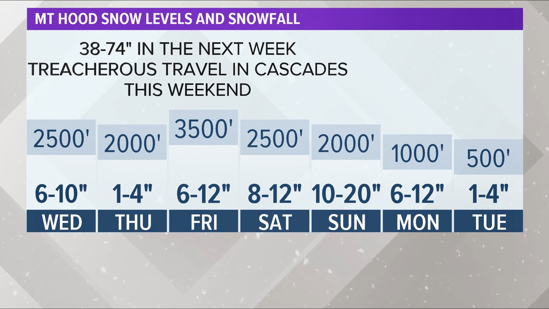
It begins Tuesday night and Wednesday morning. A Winter Weather Advisory is in effect until noon Wednesday. Snow levels could drop to 2,500 feet by Wednesday afternoon and there could be 6-10 inches of snow dropped on Mount Hood by that time.
Then the weekend comes, and with it, even more snow. Zaffino says there could up to a foot of snow dropped Friday, Saturday and Sunday with snow levels dropping as low as 2,000 feet. If you add it all up, there could be between 38 and 74 inches of snow in the mountains by next Tuesday.
Drivers should expect snowy conditions if they’re taking Highway 35 through Bennett Pass, Highway 26 through Government Camp, Highway 20 through Santiam Pass and Highway 58 through Willamette Pass.
The new snowfall will be welcomed by Oregon ski resorts. Snowpack in most areas in the Cascades are 60% or less than what is typical this time of year.
“Our snowpack right now is well below average. Give it a week. We may be at average by the time we roll into the middle of next week,” Zaffino said.
MORE: Latest KGW forecast