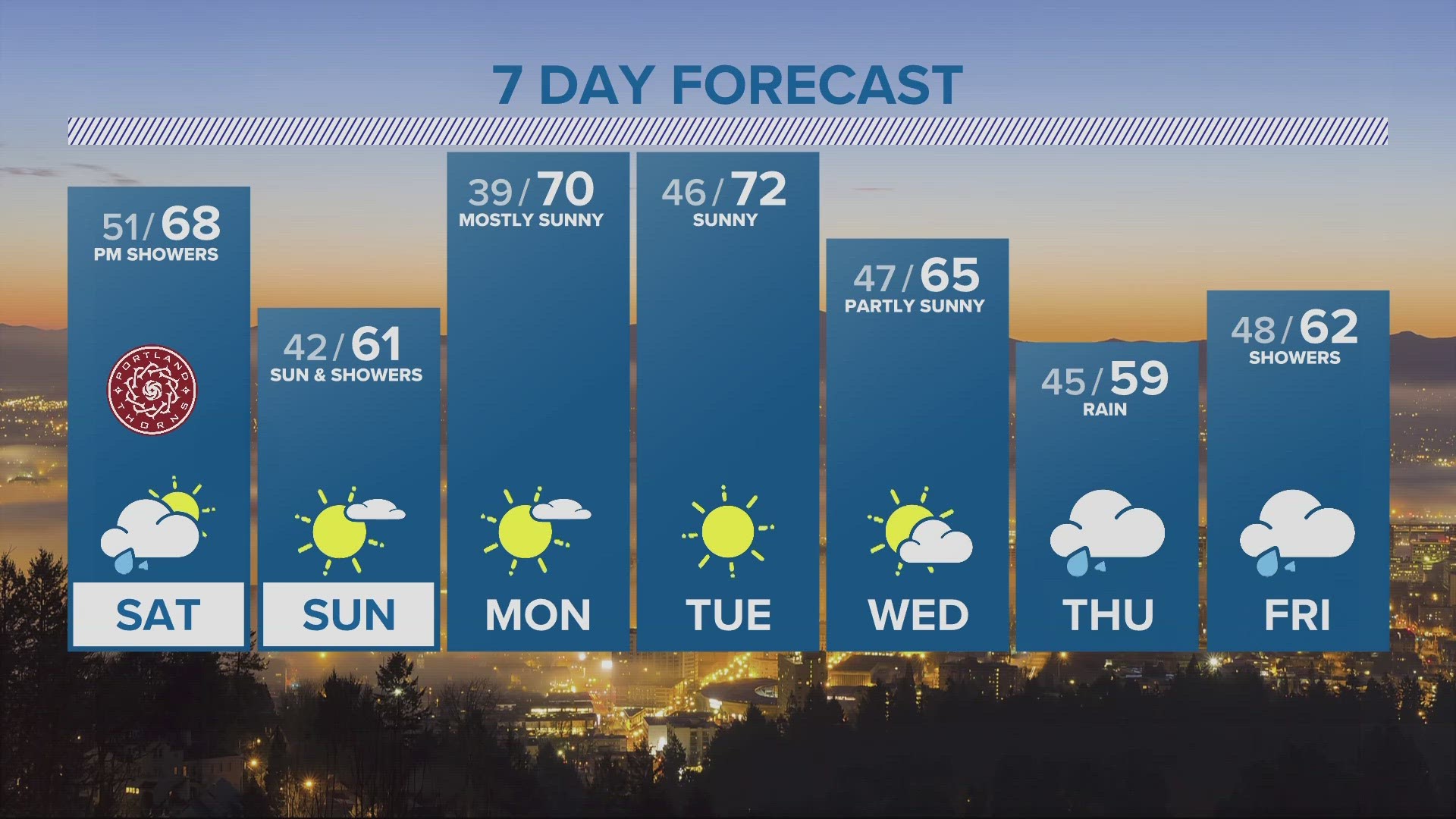
PORTLAND, Ore. — People in downtown Portland and other lower elevations of the Willamette Valley could see a dusting of snow on the ground this week. Some areas of the valley saw a wintry mix of rain and snow Tuesday morning.
A cold weather system is moving through the Pacific Northwest, making for a chilly final week of November. High temperatures in Portland are set to average 5-8 degrees below normal.
Monday morning, there were reports of snow and slushy road conditions around 1,000 feet just outside of the town of Sandy, according to KGW meteorologist Rod Hill. On the Oregon coast, there were reports of icy spots on highways.
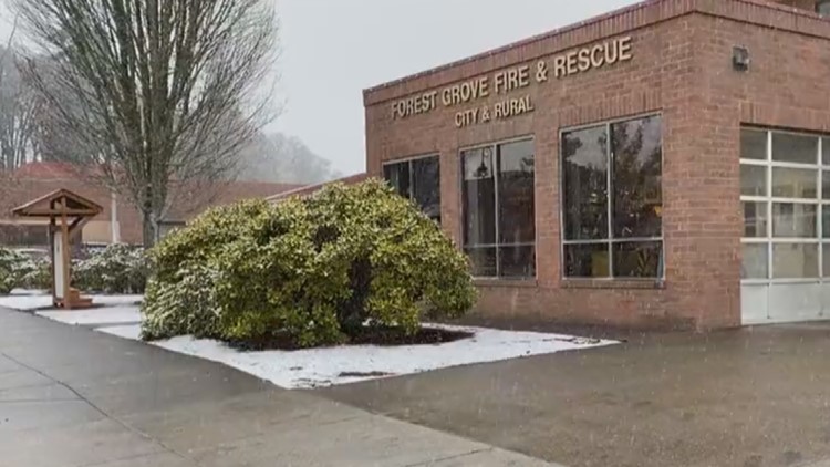
Some people in west Portland shared videos on social media showing a light dusting of snow on the ground Tuesday morning. There were also reports of some snow falling in areas including Hillsboro and Forest Grove, and icy spots on the roads around the Portland metro.
Here's a look at what to expect as lowering snow levels bring a chance of valley snow.
Snow levels in the Willamette Valley
Snow levels held above 1,000 feet Monday and will rise to 2,000 feet and higher Tuesday night, holding valley temperatures near 40 degrees overnight with heavy rains at times.
On Wednesday, the heaviest rains will end before sunrise as the front passes the Interstate 5 corridor. Heavy showers will follow during the day, with snow levels lowering to 2,000 feet or slightly lower. Showers will decrease as colder air arrives Wednesday night.
Thursday morning will mostly see snow showers over the valley and the Portland metro. Scattered dustings of snow at the lowest elevations will be possible if enough shower activity persists, according to Hill.
"Any sticking snow would melt during the day as valley temps warm into the low 40s, ending the threat of wintry weather this week for elevations below 1,500 feet," Hill said.
Wind Advisory
The National Weather Service has issued a Wind Advisory for the Willamette Valley and Southeast Washington. South wind gusts could reach 45 p.m. starting at 8 p.m. on Tuesday through 5 a.m. on Wednesday.