
PORTLAND, Ore. — Interstate 5 has reopened in southern Oregon after a "bomb cyclone" unleashed blizzard-like conditions in southern Oregon and northern California.
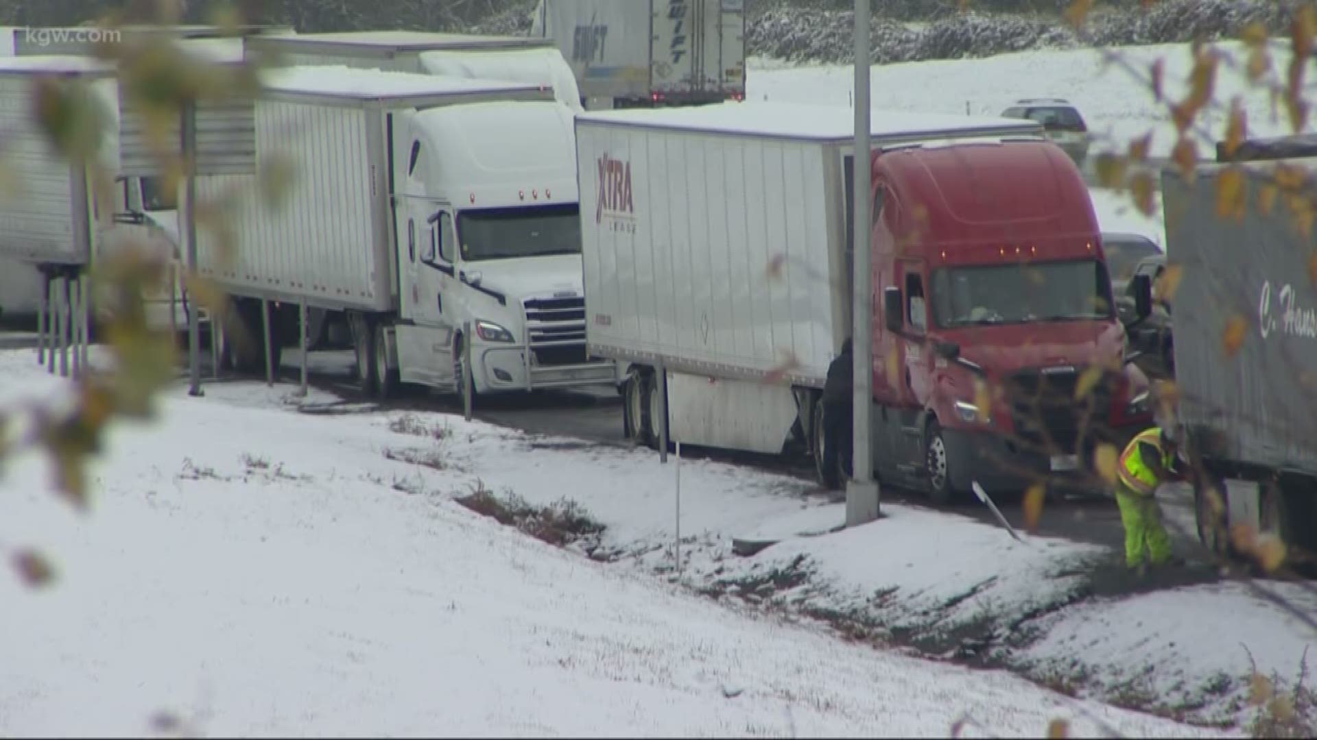
Officials closed Interstate 5 late Tuesday night in both directions from Ashland to just north of Redding, California and truckers were backed up for miles. ODOT announced shortly before 8:30 a.m. Wednesday that I-5 was open again at Ashland.
ODOT also said chains are required for all vehicles except 4x4s, unless towing. Travelers should still expect slow traffic and congestion until the backup clears.
Northbound lanes of I-5 in Redding have opened but officials are escorting traffic from north of Redding to the Oregon border.
Conditions were particularly perilous late Tuesday for drivers between Siskiyou Summit in Oregon and Redding.
Drivers reported being stuck for hours in white-out conditions and some even spent the night in their cars.
On Tuesday night, KGW meteorologist Matt Zaffino reported that the I-5 corridor from north of Roseburg down to the California border could get up to 16 inches of snow.
A blizzard warning was issued for the Southern Oregon Cascades, which is a rare occurrence in Oregon. Zaffino said visibility would drop below a quarter-mile, leading to white-out conditions.
Three highways in the Cascade Range in southern Oregon also closed Tuesday because of blizzard conditions.
OR 138, also called the North Umpqua Highway, east of Roseburg is closing at Tokatee to its junction with US 97. Oregon 62 and 230 are closing at Prospect north through Union Creek to Diamond Lake Junction.
The oncoming storm developed rapidly as it approached land, bringing a quick transition into windy weather with high precipitation rates.
A bomb cyclone, also known as bombogenesis, is simply a storm that intensifies very rapidly. Bomb cyclones form when air near Earth’s surface rises quickly in the atmosphere, triggering a sudden drop in barometric pressure — at least 24 millibars within 24 hours.
As the air rises, wind spirals in at the base of the storm. As long as the air continues to rise at the top of the storm faster than it can be replaced at the bottom, barometric pressure will continue to drop. As with a hurricane, lower air pressure yields a stronger storm.
Power outages
Utility officials are working to restore power to thousands of customers in southern Oregon and northern California because of the snowstorm and high winds.
More than 15,000 customers were without power on Tuesday night, but as of Wednesday morning, that number had lowered to less than 2,500. The largest number of customers without power Wednesday morning were in Del Norte County in northern California, where 2,149 were without power as of 8:30 a.m.
Utility officials expect outages to continue into Wednesday based on the weather forecast. Pacific Power is working with local emergency officials and the Red Cross to set up warming shelters where needed.