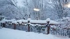
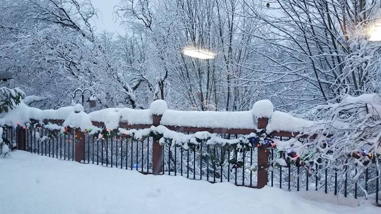
PORTLAND, Ore. — A Winter Storm Watch issued by the National Weather Service on Monday morning warned that some areas around Portland may just see a dusting of snow overnight into Tuesday and other areas could see up to 6 inches.
Given the snow event over the weekend that left some areas with several inches of snow and others with nothing, KGW chief meteorologist Matt Zaffino explained why there is uncertainty forecasting the next batch of winter weather.
Here's what he said on his Facebook page Monday afternoon. Like Matt's Facebook page for Portland area weather information
And it just keeps getting more interesting.
First, yes I'm more than aware that those of you in the south and west side of town that got zero snow over the weekend feel that that forecast was a complete bust. It certainly wasn't a perfect forecast, but for those in east Portland, Clark County and most areas above 500 ft, it actually was really good. But I understand your frustration if you didn't get any snow. Trust me, no one feels that pain more than a forecaster.
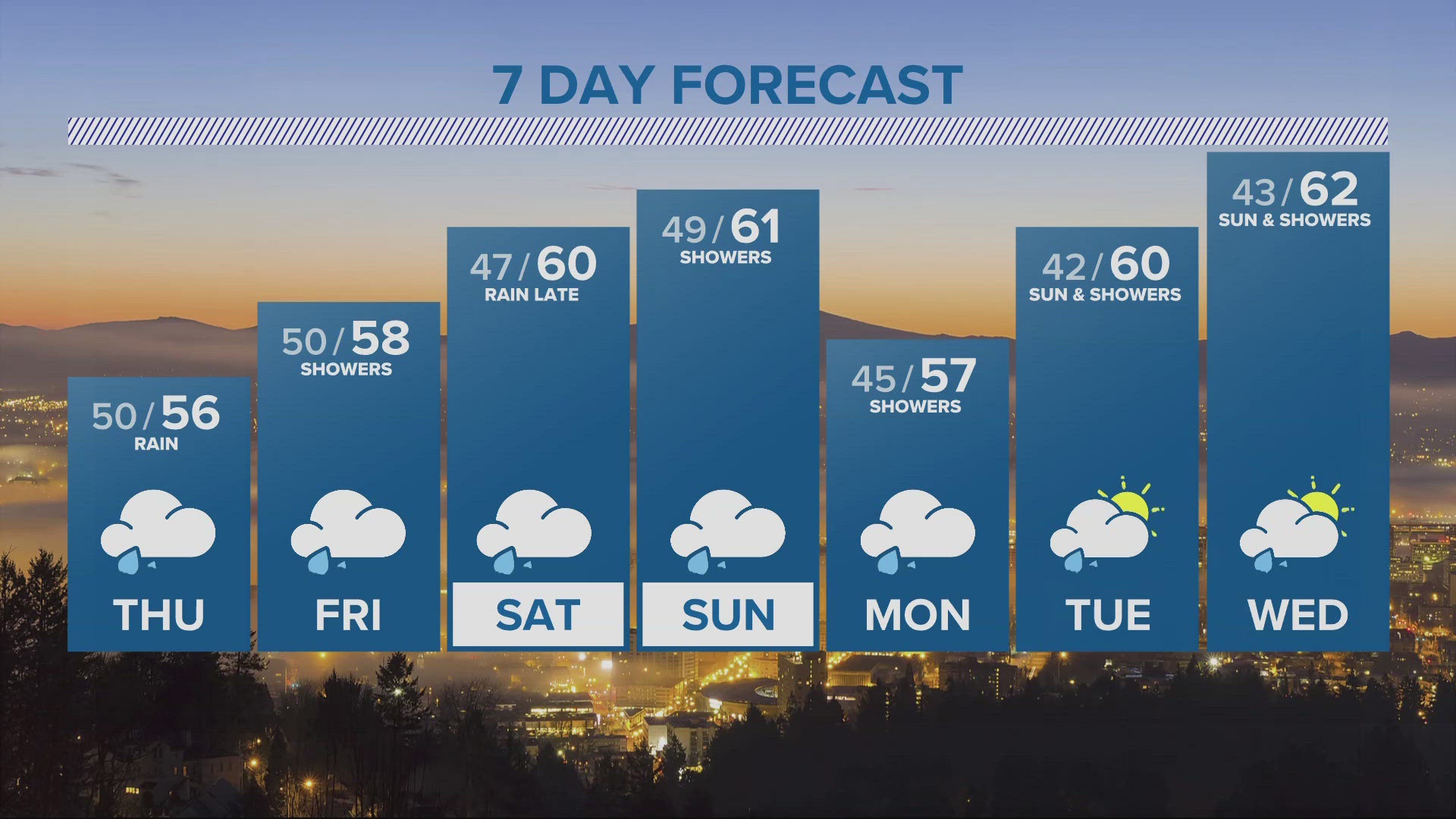
You may be aware that the Portland area is under a Winter Storm Watch for Tuesday morning. For an unusually broad range of snow, from a trace to 6 inches. I want to explain the reason for that and why there’s much uncertainty regarding what would be a very high impact event, if it happens, for Tuesday morning and its commute.
First understand the difference between a Watch and a Warning. A Watch means conditions are favorable for the watched event to occur. But it’s not saying this is absolutely going to happen. And it could be that it does not happen. It means we’re watching it closely, be aware it’s a possibility. A Warning means it’s either imminent, or happening. We’re not there yet for this one.
A Watch also doesn’t mean go elbow your way down the aisles of your grocery store and buy three weeks worth of bread and kale.
OK, on to Tuesday morning’s forecast. Right now, it’s warmed, it’s raining, the snow level has risen to 2,000 feet and there’s no east wind. So why the concern?
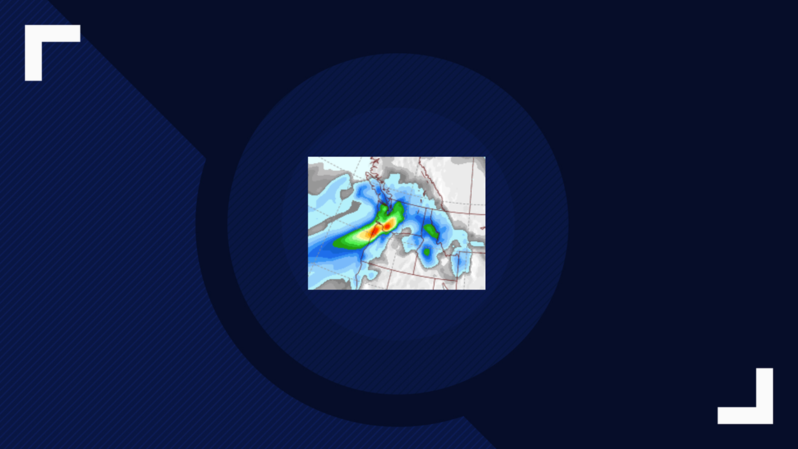
Something called dynamic cooling. That’s when strong upward motion in the atmosphere happens in an area with heavy precipitation. It actually is creates precipitation. But what can happen is this: Snowflakes fall into a ground based layer of air that’s above freezing, but the layer is not that deep. Note the afore mentioned snow level around 2,000 feet. Even with a freezing level rising to 4,000 feet briefly with this incoming storm, that’s shallow enough. Anyway, when snowflakes melt, that process requires heat, which comes at the expense of the “warmer” air. So heat is removed from the warm layer in order to melt the snowflakes. If you have A LOT of snowflakes, i.e., really heavy precipitation, you remove a lot of heat. That’s dynamic cooling, and it can lower the snow level all the way down to sea level. I’ve seen it happen. See the snowfall map below from November 2003. Giant snowflakes fell in an early surprise snowstorm Here’s a link to a an excellent technical description of that storm by Bill Schneider of the Portland NWS office:
In order to get the really heavy precipitation rates necessary for dynamic cooling to dominate, you need intense upward motion in the atmosphere. We call that “vertical velocity” in meteorology. See that attached map with the red bullseye right over western Oregon overnight and in the morning. That's forecasted vertical velocity. It's intense, and its right over an area of heavy frontal precipitation, with colder air moving in right where the heavy precipitation is falling.
So that’s the set up, all the ingredients are in play, but it’s a question of them all coming together at the same time.
This has the potential to be a high impact event. And the last thing any forecaster wants to do is miss that. We also don’t want to disappoint or cry wolf. So stay tuned, this forecast is even trickier than the last one, and we all know how that turned out: great for some, not so much for others.

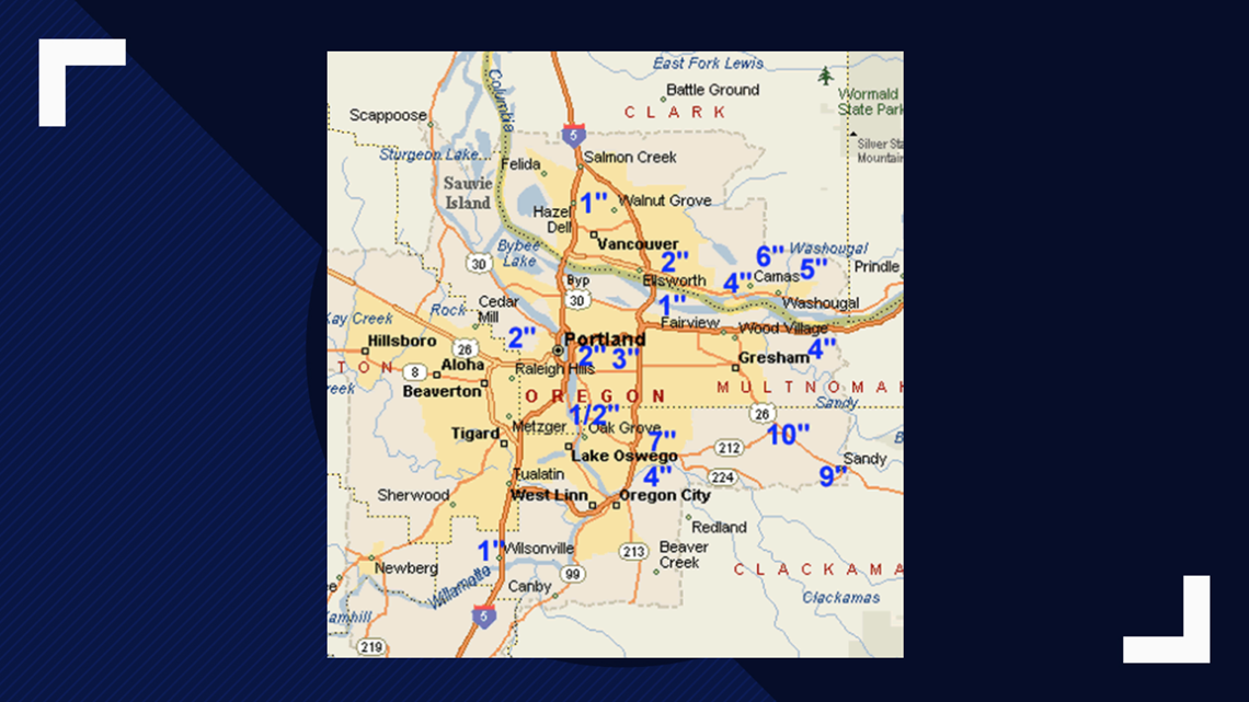
Earlier on Monday, KGW meteorologist Rod Hill explained the disparity in snowfall in the Portland area over the weekend.