
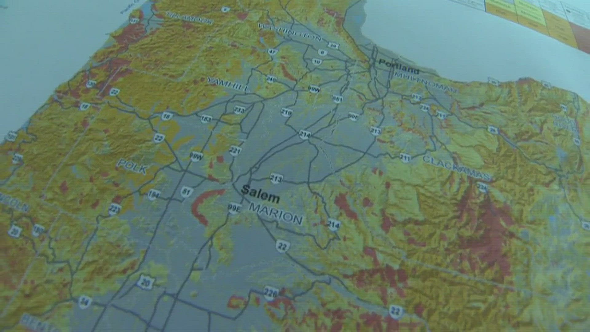
PORTLAND, Ore. -- A new landslide susceptibility map of Oregon helps identify areas that may be at risk for future landslides.
State geologists say the map will help Oregonians better understand the potential hazard in their own communities.
it will also help them prioritize areas for future in-depth mapping and study of landslide hazards.
More than a third of Oregon's land has very high or high landslide susceptibility.
Very high susceptibility means the area is an existing landslide. High susceptibility means landsliding is likely.
The mapping marks the first time since the early 80s that there's been a look at the landslide susceptibility of the entire state.
"Studying landslides helps Oregon understand where taking action might decrease the risk to people, buildings and infrastructure," said Bill Burns, engineering geologist for the Oregon Department of Geology and Mineral Industries.
The new landslide hazard information can also help Oregonians protect themselves and their property.
State geologists say by knowing which areas are susceptible to landslides, people can identify places to avoid during extreme weather. It can also help people determine whether hiring a geotechnical professional to evaluate their property may be necessary.
The new mapping has been added to SLIDO, DOGAMI's interactive landslide hazard map.
More top stories:
Follow us on Facebook for the latest breaking news updates
Get news, weather & traffic updates on the go with the KGW News app