DETROIT — One of Oregon’s most popular backpacking routes will look a lot different in coming years.
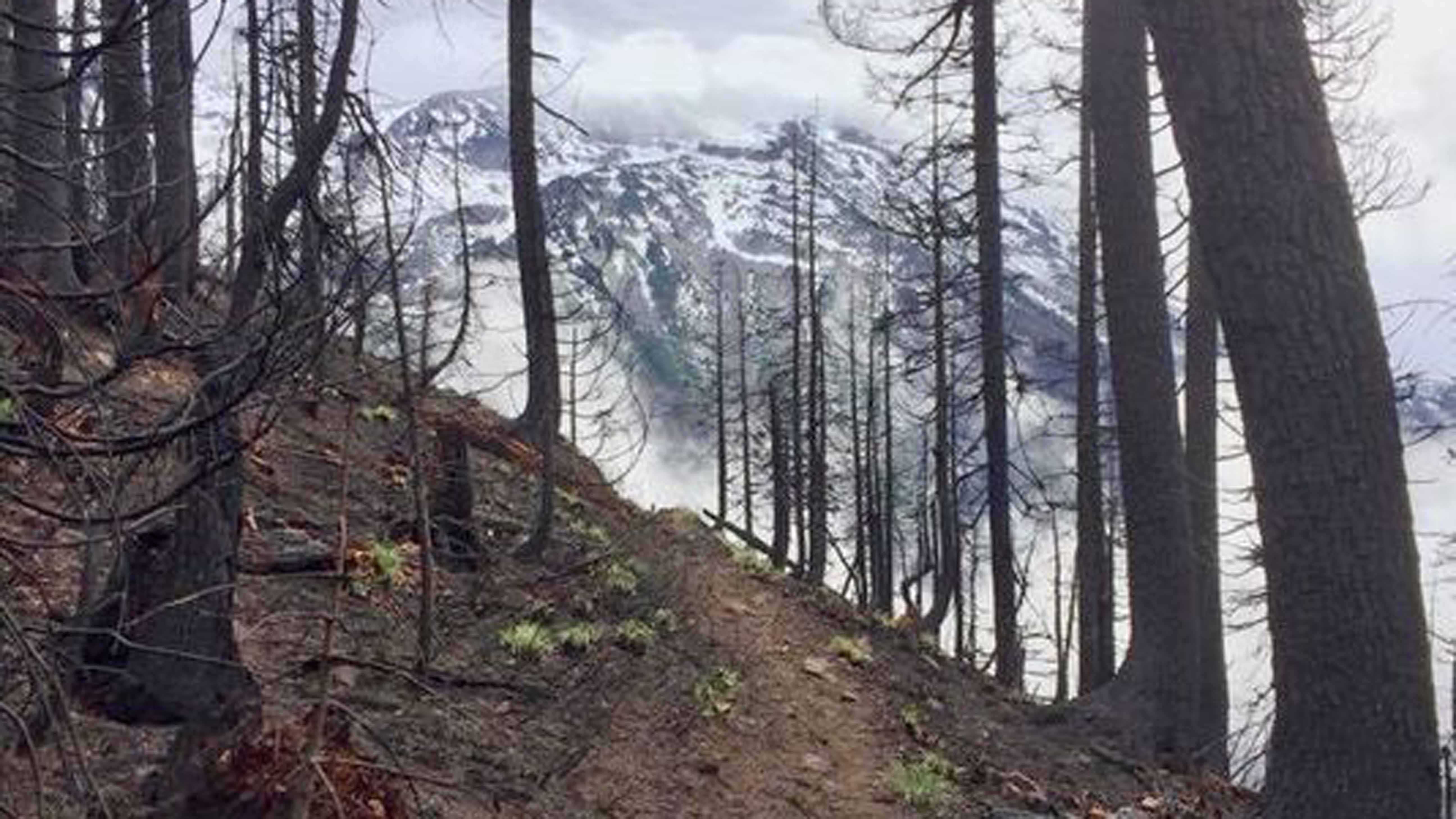
Whitewater Trail, the most common route into the Mount Jefferson Wilderness, was severely burned and blackened by the 11,500-acre Whitewater Fire this summer, officials said.
Damage to the 4.2-mile trail will keep it closed until late summer of 2018 at least, Detroit district ranger Grady McMahan said.
“I’d say about 60 to 70 percent of the trail burned in standing fire, meaning all the trees are going to be dead and we’ll mostly be starting over,” said McMahan, who hiked the trail last week.
“I recognized parts of it, but overall it looked pretty different, and many of those big old-growth trees are gone,” he said. "There are a lot more amazing views of Mount Jefferson, though."
The assessment was the first in a series that will examine the impact Whitewater and other wildfires had on the Mount Jefferson area this summer.
Most of the northern half of the wilderness area remains closed.
Whitewater Trail is popular primarily because it’s the quickest and easiest route to Jefferson Park, an alpine meadow home to mountain lakes at the base of Oregon’s second-tallest mountain.
Jefferson Park and segments of the Pacific Crest Trail nearby did not burn significantly, McMahan said.
The Whitewater Fire ignited just a few hundred yards off Whitewater Trail and scorched the area in multiple runs that burned extremely hot, McMahan said.
In other areas, such as up the Pacific Crest Trail, the fire burned at moderate intensity, blackening undergrowth rather than standing trees.
The work required before reopening the trail will be extensive, McMahan said.
Dead trees will fall across the trail during winter and spring, while heavy rain and snow will likely cause landslides and erosion on the pathway.
Forest Service Road 2243, which leads to Whitewater Trailhead, will also need work to reopen.
“It’s going to require extensive clearing of hazard trees and we’re already seeing some drainage problems,” McMahan said. “It’s going to take a little while.”
Other areas likely impacted by the fire include Cheat Creek, Woodpecker Ridge and Triangulation Peak trails.
Current closures in Mount Jefferson area
Roads Closed
· Forest Service Road 2243 (Whitewater Road)
· All other roads within the closure area
Trails Closed
All trails into Jefferson Park
· All trails into Pamelia Lake Trail Area including Pamelia Lake #3439
· Bear Point #3342
· Bingham Ridge #3421
· Cheat Creek #3441
· Crag Trail #3364
· Crown Lake #3362
· Grizzly Peak #3428
· Hunts Cove #3430
· Hunts Creek #3440
· Independence Rock #3431
· Independence Rock Summit #3431.1
· Lake Of The Woods #3493
· Leone Lake #3367
· McCoy #4168
· Minto Mountain #3448
· Minto Pass Tie #3437
· Old Hunts Cove #3451
· Roaring Creek #3361
· Rockpile Lake #3632
· Shirley Lake #3451
· South Breitenbush #3375
· South Breitenbush Gorge #3366
· Sugar Pine Ridge #4002
· Swallow Lake #3488
· Triangulation #3373
· Triangulation Peak #3374
· Whitewater #3429
· Woodpecker Ridge #3442
· Pacific Crest Trail: See the Pacific Crest Trail Association website for PCT trail conditions and closures
Zach Urness has been an outdoors writer, photographer and videographer in Oregon for nine years. He is the author of the book “Hiking Southern Oregon” and can be reached at zurness@StatesmanJournal.com or (503) 399-6801. Find him on Twitter at @ZachsORoutdoors.